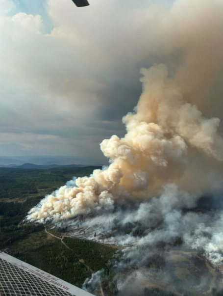
BC Wildfire Service is expecting fire behaviour to increase for the Rossmoore Lake wildfire, especially in areas with direct sunlight, due to increasing temperatures.
Starting today, there will be a trend to warmer and drier conditions, with the forecast calling for light winds, a high of 28°C and lower humidity than the past two days.
Operational objectives remain consistent, with work on containment line construction continuing along the south flank, and guard being constructed northeast of Frogmoore Creek.
“Heavy equipment is reinforcing contingency guards from the transmission line east to the pipeline,” BCWS adds.
Mop-up and patrol are ongoing along the northern section of the fire, working in a clockwise direction from Ross Moore Lake to Nichol Lake.
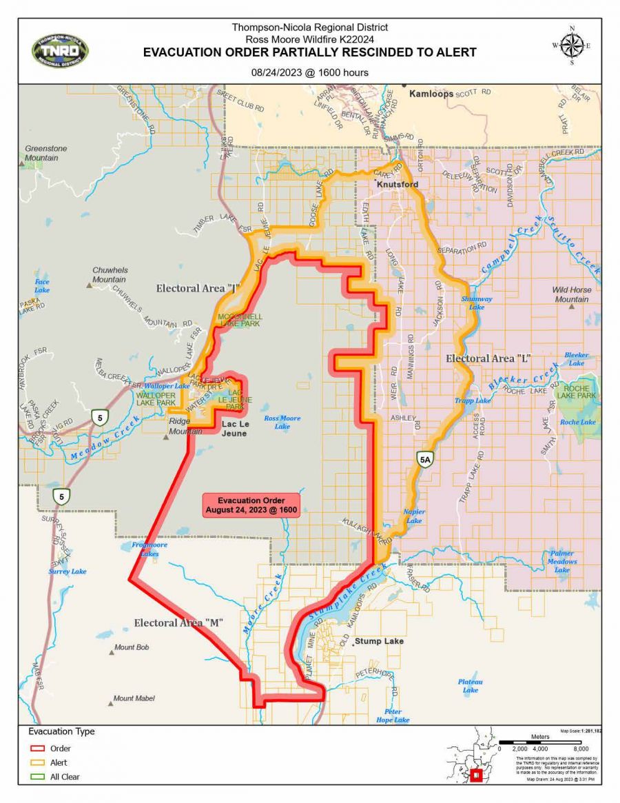
An evacuation order remains in effect for 10 properties in electoral areas J, L and M, and 344 properties are under evacuation alert due to the Rossmoore Lake wildfire.
The area surrounding the Rossmoore Lake wildfire is still an active worksite, and members of the public should be aware that significant safety hazards may be present, including:
- heavy equipment, aircraft and personnel engaging in suppression activities
- danger trees (fire-damaged trees that have become unstable and could fall over without warning)
- ash pits, which may be hard to detect and can remain hot long after the flames have died down
- unstable soils and terrain
- increased potential for landslides or rock falls
- damaged trails or irregular trail surfaces
- increased water runoff, which could lead to flooding or debris flows
All unnecessary travel through the area should be avoided.
As of 10:38 am today, the Rossmoore Lake wildfire, located approximately 10 kilometres south of Kamloops, is estimated to be 7,853 hectares.
It remains out of control, and smoke may be visible from Kamloops, Highway 5, Highway 5A and the surrounding area.


