Let’s hope for a drier spring this year. The B.C. River Forecast Centre has released its latest snowpack data, but says April’s numbers and spring weather will be the clincher in determining this year’s flood risk in Kamloops.
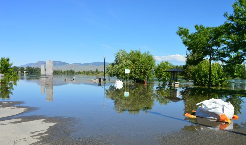
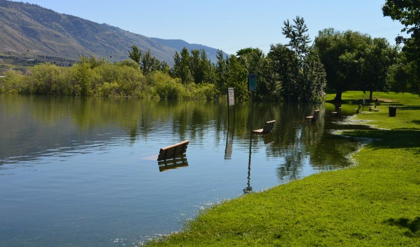
Much of the Interior suffered from flooding last year, nowhere worse than the Okanagan Valley. In Kamloops, the Thompson River was on flood watch in June and area creeks caused some damage in the spring when water levels rose quickly.
According to the latest numbers from the forecast centre, a near normal snowpack has developed in the North Thompson basin and an above normal snowpack is present in the South Thompson. As of March 1, the North Thompson basin is at 105% of normal and the South Thompson is at 111%.
David Campbell, section head for the B.C. River Forecast Centre, said although those numbers are a little above normal, they are within the range experts would typically expect, and are associated with a normal seasonal flood risk. April’s numbers will give a clearer picture as there is still about four to eight weeks left where snow can continue to accumulate, he said.
“We do expect the numbers are going to jump a little bit and we might be on that borderline by the end of the season of maybe getting into an elevated flood risk scenario for the Thompson. We’re not there yet but that’s a direction we may be heading,” Campbell said.
Of course, snow is just one piece of the puzzle, Campbell said. The main driver of last year’s flooding was wet weather during the melting season, especially in the Okanagan. Campbell said snowpacks were around 90% of normal last year.
“That’s the concern for us. If we were to superimpose the same weather patterns as last spring onto this year’s snowpack, that could mean much more serious flooding through many parts of the province,” Campbell said.
Campbell said the Thompson Rivers peak late because of their size, sometimes into early July, while smaller tributaries peak earlier in the spring, possible even late April.
“We put out or next bulletin on April 7 and April is the one we kind of use for our benchmark for seasonal flood risk because we are at, for the most part, nearing the end of that accumulation season, so we have a good handle on how much snow there is,” Campbell said.
In preparation for the spring melt, the City of Kamloops has already made sand and sandbags available at the following fire halls: Valleyview, Dallas, Brock and Westsyde.
Snowpack data from the B.C. River Forecast Centre can be found here.


