Even as Kootenay Lake’s shoreline continues to be ‘degraded’ a new strategic plan is being developed to slow and eventually halt illegal development on main body of water in the area.
A five-year strategic plan is being proposed for development by the Kootenay Lake Partnership (KLP) — with a proposal for support from the City of Nelson for $2,000 for development — to join with the Regional District of Central Kootenay to draft a plan.
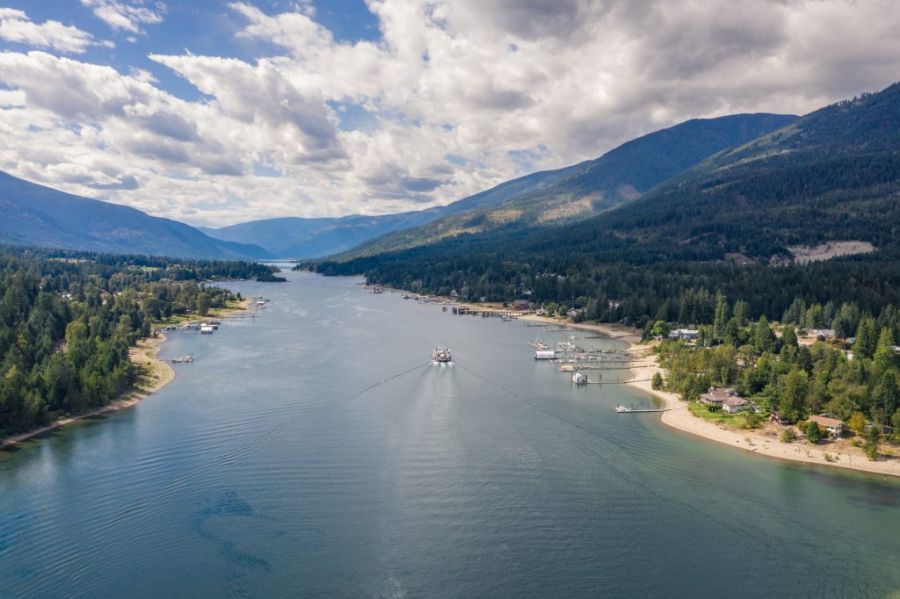
A shoreline inventory was conducted in 2011 and, 10 years later, it was conducted again, uncovering a total of 4.5 kilometres of shoreline having been degraded in that time, said KLP coordinator Claire Peyton.
“So, even with the shoreline guidance document in place, we are still experiencing rapid shoreline loss, so that is why we have been working hard to … set in place this regional environmental development permit area,” she said.
The permit area would be 30 metres wide and run around the entire length of the lake.
“(We) wouldn’t be able to say no to development, but we would have a little more control on what happens where,” she said.
From an indigenous perspective, the Ktunaxa Nation is extremely concerned about this, Peyton explained when she spoke to City council recently on the matter.
“As you are aware, fish stocks in Kootenay Lake have been a disaster for a number of years in Kootenay Lake … and fish health is very connected to shoreline health which is how we are managing development on the lake,” she explained. “(We are t)rying to tackle it through the shoreline guidance document, landowner outreach and through inventories understanding what is being lost.”
The KLP was formed in 2010 as a multi-agency initiative — including the Ktunaxa Nation and the federal Department of Fisheries and Oceans — to support a productive and healthy Kootenay Lake ecosystem, and prompted by “great concern over the rapid rate of development along the shoreline of Kootenay Lake.”
The purpose of the KLP is promote interagency communication and collaboration to help protect the immense values of Kootenay Lake, said Peyton.
“(The KLP) did not think they could protect the shoreline values, and the indigenous values, with the rapid rate of shoreline development taking place,” she pointed out.
The KLP operates under a Shoreline Guidance Document (SGD) and receives $10,000 from the regional district for the year, but it also looks to include other partner agencies — such as the City of Nelson — in the partnership mix since it hosts a significant piece of Kootenay Lake foreshore.
Coun. Jesse Woodward asked who was in control on the lake with several jurisdictions in place.
“Some of the works happening on the lake are illegal and there is not a lot of compliance and enforcement present on the lake so, in response to that, the Kootenay Lake partnership has established a compliance and enforcement committee that represents federal, provincial and regional compliance and enforcement staff.
“Those groups get together quarterly to see how to better leverage resources to have a better presence on the lake,” said Peyton.
Part of problem is homeowners not knowing the rules and regulations, Peyton said. Now that Friends of Kootenay Lake is on hiatus and not functioning, the partnership may re-invigorate the group to get it re-started and help with education and compliance.
Many layers
Work along the shoreline is very complex and involves many levels of jurisdiction, which is why the partnership exists.
The partnership sits to figure out how to manage the various interests and considerations around Kootenay Lake, Peyton explained.
The lake is divided into segments and the features of each one are rated to protect those values.
There have been many referrals come through the partnership since it was created, and every referral now has to use the shoreline guidance documents.
“It’s really been a huge thing … and Kootenay Lake has been a leader in how to integrate cultural values into decision making,” she said.
Shoreline areas identified as requiring enhanced engagement with the Ktunaxa Nation Council are those that are anticipated — based on current information — to be more complex and require a more in-depth review by the Ktunaxa Nation Council or one of its member communities, said Peyton.
“Decisions made within enhanced engagement areas will generally call for increased Ktunaxa Nation involvement,” she stated.
Purpose of the SGD
The SGD is the keystone document of the partnership.
The guidance document outlines the permitting process according to risk level for shoreline activities such as docks, retaining walls and dredging, among others in an effort to protect those values.
As well, the document identifies sensitive habitat, Ktunaxa cultural values and pre-contact archaeological potential, in addition to helping residents navigate complex local, provincial and federal regulations.
The SGD consolidates existing regulations to streamline processes, while providing direction on how to obtain the necessary approvals for various forms of development on Crown land within the Kootenay Lake foreshore.
The document also helps “improve evidence-based decision-making to protect ecological, cultural and archaeological values around Kootenay Lake.”


