Account Login/Registration

Access KamloopsBCNow using your Facebook account, or by entering your information below.


Facebook


OR


Register

Privacy Policy

UPDATE: Ross Moore Lake fire grows to 2,600 hectares

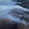
(UDATE: July 24 @ 4:25 pm) – In the latest update from the BC Wildfire Service, the Ross Moore Lake wildfire has grown by about 600 hectares.

The fire is now estimated at 2,600 hectares.

Ground crews were on site throughout the day on Monday with more crew members en route to support suppression operations.

<who> Photo Credit: BCWS

“Ground personnel will work with a heavy equipment task force to construct machine guards,” says the BCWS.

“Airtankers and helicopters have been providing aerial support which allows for ground crews to continue work on guard building objectives.”

This fire continues to be highly visible from Kamloops and Highway 5A.

Kamloops fire Rescue members are supporting the BCWS firefighters that are on the scene. This includes providing personnel and fire fighting equipment.

As of 4:20 pm, all evacuation orders and alerts issued by the Thompson-Nicola Regional District remain in effect.

For information on how to access the emergency operations centre at the McArthur Island Sports and Events Centre in Kamloops and how to register with the provincial emergency support services portal, click here.


(Original story: July 24 @ 9 am) – Nearly 350 properties south of Kamloops have been forced to evacuate Sunday night due to the nearby Ross Moore Lake wildfire.

On Sunday, July 23, the BC Wildfire Service said the fire was estimated at 1,800 hectares.

A new update for Monday has yet to be released.

Due to the growth of the fire over the weekend, the Thompson-Nicola Regional District issued an expanded evacuation order for 344 properties in the electoral areas “J” (Copper Desert Country) and “L” (Grasslands) late Sunday night.

This includes properties in the Lac Le Jeune area; Long Lake Road and adjoining roads south of the intersection with Goose Lake Road; areas south of Goose Lake Road, including Edith Lake Road; and all areas west of Highway 5A from Napier Lake to just south of the Knutsford Campground.

<who> Photo Credit: Thompson-Nicola Regional District </who> A map showing the most recent evacuation order and alert areas in the TNRD electoral areas “J” (Copper Desert Country) and “L” (Grasslands).

People who have been evacuated must leave the area immediately and head to the evacuee reception centre on McArthur Island in Kamloops.

Anyone who has been forced to leave their homes should ensure they have critical items like medicines, wallets and keys.

Evacuees are also urged to register online by visiting ess.gov.bc.ca/.

An evacuation alert also remains in place for around 157 properties in the same electoral areas.

“This Evacuation Alert is in place to prepare you to evacuate your premises or property should it be found necessary. Residents will be given as much advance notice as possible prior to an Evacuation Order; however, you may receive limited notice due to changing conditions,” says the TNRD.

No evacuation orders have been issued within the limits of the City of Kamloops, however, an alert is in place for Knutsford.

This story will be updated throughout the day on Monday with updates from the BC Wildfire Service.

<who> Photo Credit: City of Kamloops <who> A map showing the city limits for Kamloops, which has a small evacuation alert area.


Send your comments, news tips, typos, letter to the editor, photos and videos to [email protected].


weather-icon
Tue
23℃

weather-icon
Wed
21℃

weather-icon
Thu
18℃

weather-icon
Fri
19℃

weather-icon
Sat
18℃

weather-icon
Sun
22℃
current feed webcam icon

Top Stories

Follow Us

Follow us on Instagram Follow us on Twitter Like us on Facebook Follow us on Linkedin
Follow Our Newsletter
Privacy Policy